AEC
BIMBOSS CONSULTANTS
AI Technologies
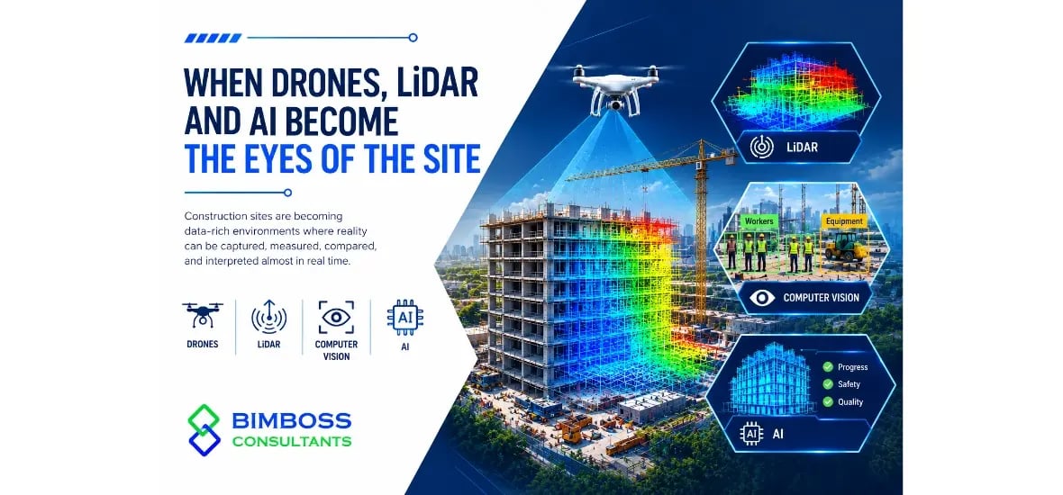

Construction sites are becoming data-rich environments where reality can be captured, measured, compared, and interpreted almost in real time. Drones, LiDAR, computer vision, and AI are changing how teams understand what is happening beyond the BIM model.
Drones are becoming more than tools for taking impressive aerial photographs. Equipped with high-resolution cameras and surveying technology, they can capture large construction areas quickly while reducing the need for repeated manual inspections.
A drone survey can help teams understand:
Current construction progress
Material and equipment locations
Site access and logistics
Earthwork and stockpile conditions
Exterior installation progress
Safety and housekeeping conditions
Changes between planned and actual site conditions
When repeated throughout a project, these captures create a visual timeline of construction rather than isolated progress photographs.
While drone imagery shows what the site looks like, LiDAR adds another dimension: measurable spatial information.
LiDAR scanners can capture dense point clouds representing buildings, structures, terrain, equipment, and surrounding environments.
This information can then be processed into accurate 3D representations that can support surveying, verification, Scan-to-BIM, and as-built documentation.
Instead of relying entirely on manual measurements, project teams can identify where constructed conditions differ from the digital model and investigate those differences earlier.
Capturing more site data does not automatically make construction smarter. The challenge is understanding that data quickly enough to make decisions.
This is where AI becomes important.
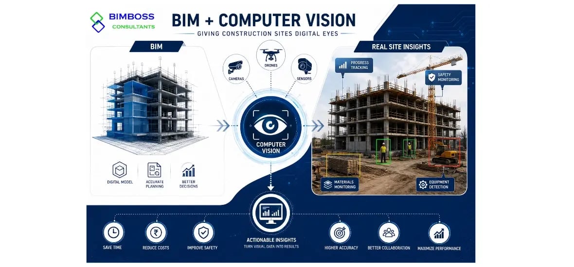
Computer vision models can analyze construction imagery to recognize objects, track progress, identify unsafe conditions, and detect changes.
The drone captures. LiDAR measures. AI interprets. BIM provides the context.
 The biggest opportunity is not any single technology. It is the connection between them.
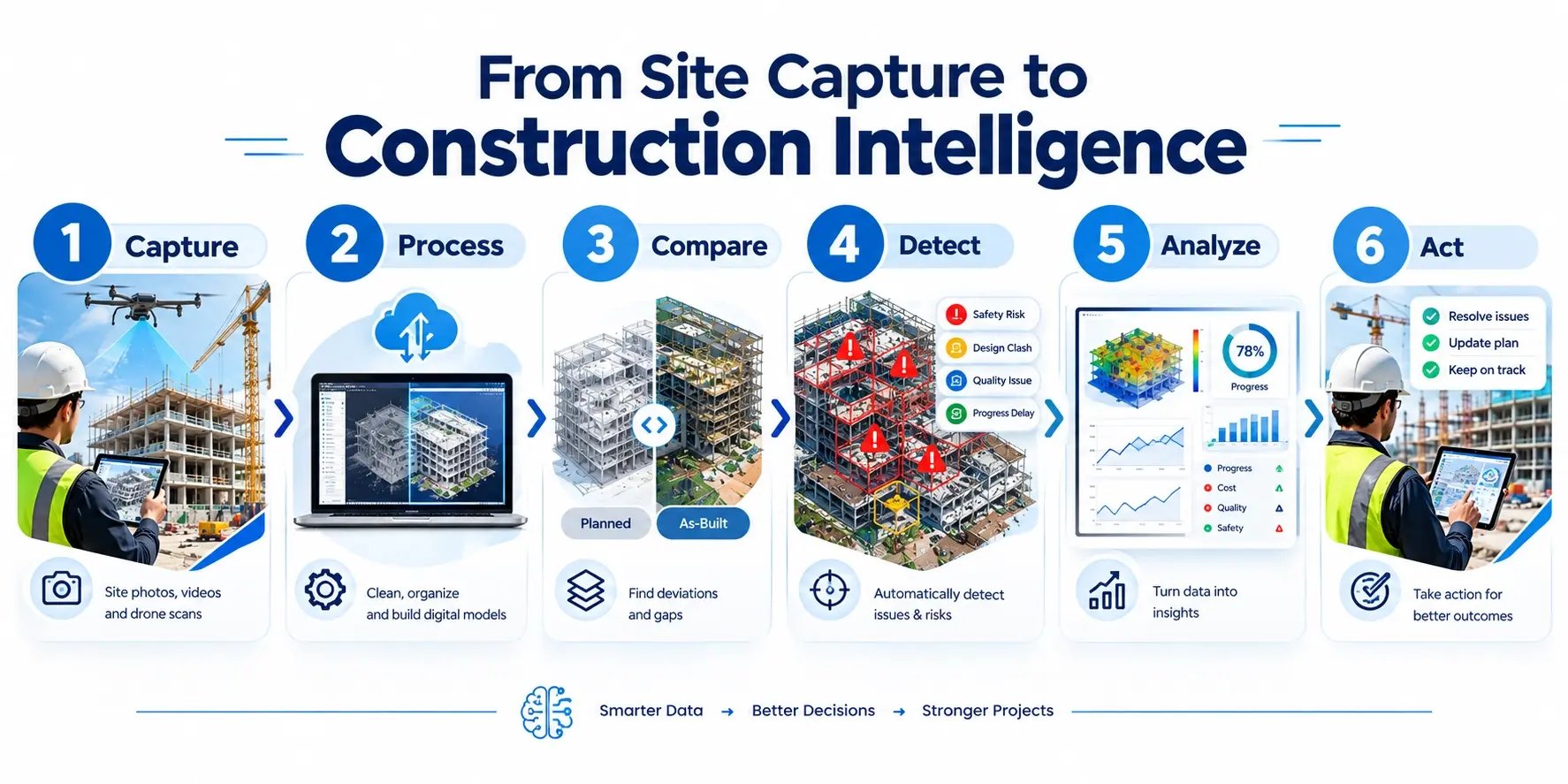
A modern verification workflow can look like this:
Capture → Process → Compare → Detect → Analyze → Act
Drones, LiDAR scanners, 360° cameras, and other reality-capture technologies collect information from the site.
The captured information is converted into usable imagery, point clouds, meshes, or structured datasets.
Site conditions can be compared against BIM models, drawings, schedules, or previous site captures.
Differences, incomplete work, spatial deviations, or potential issues can be identified.
AI can help classify findings and determine which observations may require immediate attention.
Project teams can use those insights to coordinate work, verify progress, update documentation, or address problems before they become expensive.
Reality capture becomes significantly more powerful when it connects with BIM.
A drone may show that a particular area has progressed. LiDAR may show its exact geometry. But BIM can provide the intended design information behind that geometry.
This creates a bridge between what was designed, what was planned, and what was actually built.
For BIM teams, this can support Constructability reviews, progress verification, coordination, as-built modeling, quantity validation, and digital twin development.
Construction produces enormous amounts of visual information. Reviewing every image manually is time-consuming, especially on large or geographically distributed projects.
AI can assist by continuously examining captured information for specific patterns.
For example, AI-based systems can help identify:
Missing or incomplete installations
Changes in construction progress
PPE and safety issues
Equipment movement
Material accumulation
Site access changes
Potential quality concerns
Differences between planned and observed conditions
AI does not eliminate the need for engineers, surveyors, or site professionals. Instead, it can reduce the amount of repetitive observation required before experts focus on the decisions that matter.
When site reality is captured repeatedly and connected with BIM, the project can move toward a more dynamic digital representation.
A digital twin can combine information from the physical environment with model data and operational information.
This creates possibilities for continuous verification rather than one-time documentation.
The model becomes less like a static digital drawing and more like a living information environment connected to the physical project.
The construction industry is moving from periodic observation toward continuous reality capture and intelligent verification. Drones provide the perspective, LiDAR provides the geometry, AI provides the interpretation, and BIM provides the digital context.
From capturing site conditions to making smarter construction decisions — the future is already taking shape.
At BIMBOSS CONSULTANTS, we believe connected BIM workflows and intelligent digital technologies are key to building more informed, efficient, and data-driven projects.
Let's turn construction data into construction intelligence. While Pin-acle-Info-teh provides digital design and BIM solutions, BIMBOSS CONSULTANTS offers comprehensive DESIGN & BIM services tailored to project-specific requirements.
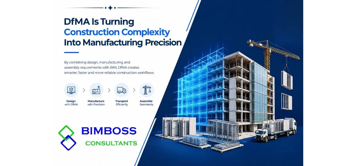
DfMA Is Turning Construction Complexity Into Manufacturing Precision
BIM + Computer Vision: Giving Construction Sites Digital Eyes